 |
| Minneapolis, 2014. Photo by Michael McKinney |
 |
| Minneapolis, 2014. Photo by Michael McKinney |
 |
| Saint Paul, 2014. Photo by Michael McKinney |
 |
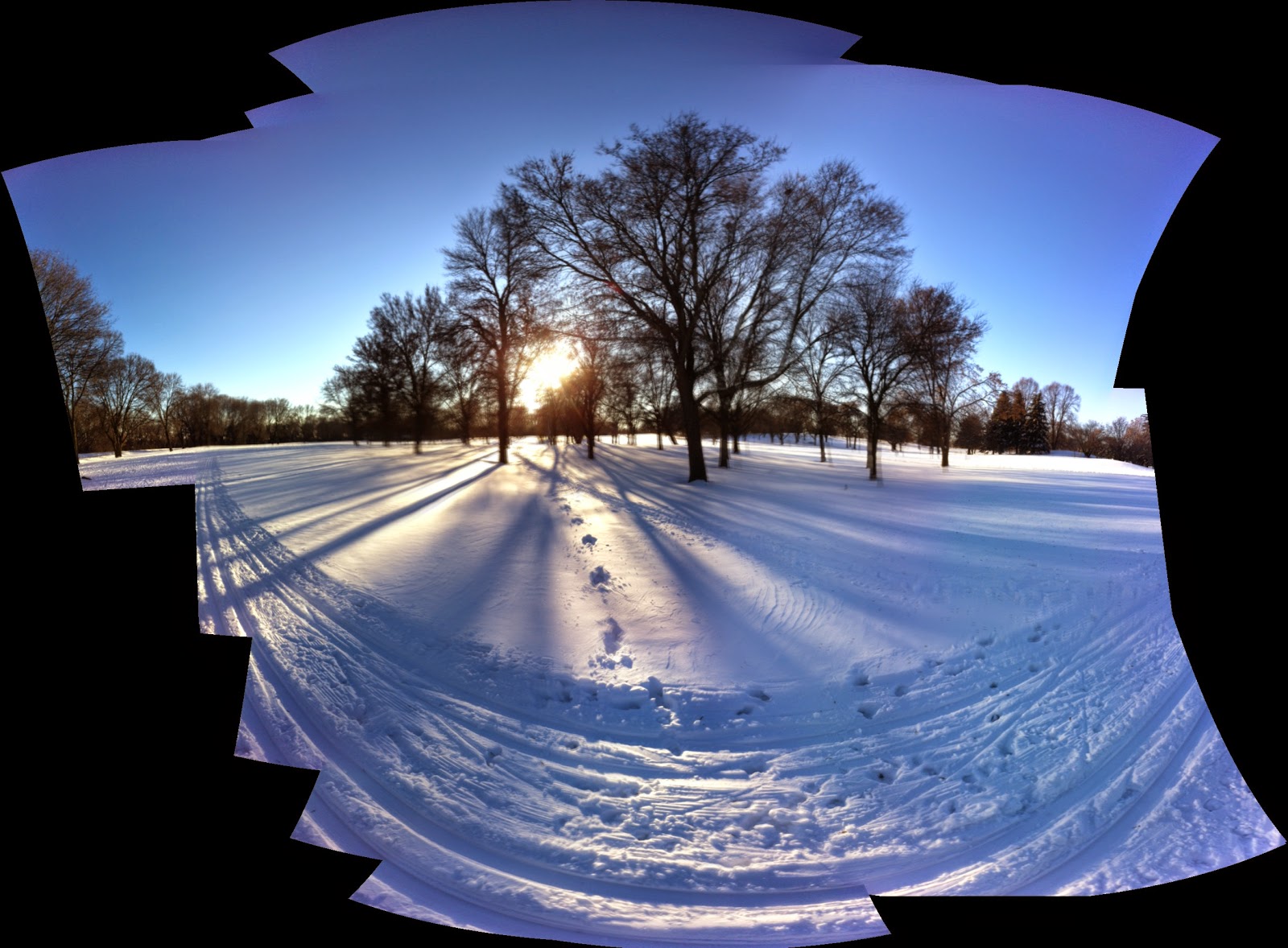
| Minneapolis, 2014. Photo by Michael McKinney |
 |
| Lake Minnetonka, 2014. Photo by Michael McKinney |
The long story is pretty complicated, so I'll shorten it to 2008, when a cousin of mine in Colorado printed out a GPS map of a fifty mile bike ride from Fort Collins to Boulder. I was riding his steel frame road bike, and though I had never ridden the route, it was easily the highlight of 2008 - I didn't get lost, it was a fairly challenging ride, and I handled it. I even enjoyed it. I surprised myself, really.
A hogback in Colorado is what the Boulder locals call a hill, and in Minnesota, it's what a lot of people would look at cross eyed and say "...that's the biggest hill I've ever seen." In a state with 55 mountain peaks over 14,000 feet high, it's pretty easy to see why misinterpretations regarding elevation are bound to happen. Take a minute to google "Number of 14,000 foot peaks in Minnesota" and reward yourself with a broad understanding of regional linguistics.
Anyway, this particular bike ride had a few good hogbacks and fifty miles at elevation, so my cousin planned it for me in advance with a map from MapMyRides and BikeRouteToaster, a fairly simple mapping program. When I got back to the level headed Midwest, I spent some time learning about MapMyRide; going on a bike ride on familiar roads, getting home, walking to a library and charting out my ride, sometimes printing out the BikeRouteToaster results for elevation and sometimes saving the work on MapMyRide.
Footnote, manually mapping a fifty mile bicycle ride on a public library computer and then having the map lost after a system wide reset is a little frustrating, almost as frustrating as the same thing happening at a coffee shop where the wi-fi is free as long as your coffee is pricey enough.
One thing led to another, and in 2013 I bought a wrist top GPS - a Garmin 210 heart rate monitor and GPS computer. No more manual mapping, but lots of statistics and Stravasshole-ism, (I had no idea "King of the Mountain" was anything but a game kids play at snowpiles while waiting for the bus), but there you go. Since then, the mapping and recording of rides has been a lot simpler. Rather than spending up to an hour manually entering turns and miles on MapMyRide, I plug in the Garmin 220, (I upgraded in 2014 after some technical issues), upload the data to Strava, MapMyRide and Garmin Connects and get on my way.
That is as uncomplicated as I can make it.
Thanks for reading, and here is my favorite bike ride from 2014, a double loop through the fairly hilly region of Cherokee Park, Kaposia Park and Mendota Heights, Minnesota.
No comments:
Post a Comment